|
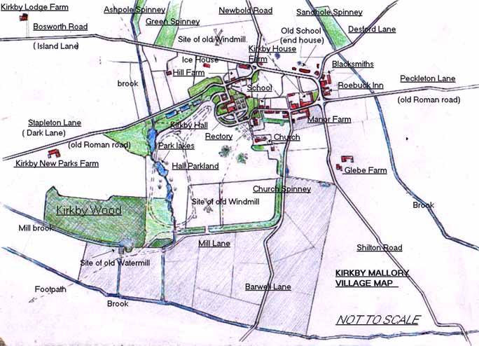
The shaded area in the above map indicates the position
of the Manor Farm fields. Also shown in dotted outline is the
position of the proposed construction of the Mallory Park race
track, plus the area of Kirkby Wood that was levelled to accommodate
it.
|
Kirkby hall  |